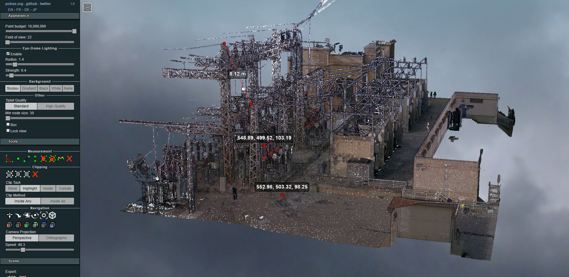
Laser scanning of an electrical substation
- Uncategorized



Besora Castle
Besora Castle is a Romanesque building located in Santa Maria de Besora (Osona) that has been declared a Cultural Asset of National Interest. It crowns a hill to the west of the village at an altitude of 1,023 meters, of which today only the ruins remain.
Only very badly damaged remains of wall fragments remain. The only clearly visible remains are those of the castle church, dedicated to Saint Mary. For more information about the castle, you can consult the following link: Besora Castle.
Needs
The Archaeology Company Attics (Association of Cultural and Social Research Technicians, S.L.), with whom we regularly collaborate, in response to the Friends of Bisaura Association's need to record and document the archaeological complex that includes the Church of Santa Maria and Besora Castle, puts us in touch with them in order to carry out the work. It is a strategic site, perched on a cliff and well-situated, which has been a military objective since pre-Roman times.
From Altiplà, photogrammetric surveying of both the structures and the entire site was proposed as the most suitable solution. This type of survey is highly useful in archaeological work due to its recording capabilities and the high precision it provides. Using various fixed-lens reflex cameras, surveying instruments, GPS, and drones adapted for this type of work, the survey was carried out with an accuracy of 0.002 m on the built volumes or remains of structures.
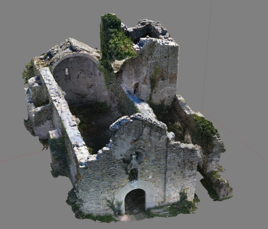
Church of Santa Maria. Textured 3D model
The final result is a three-dimensional model of the entire assembly from which all types of sections and elevations can be obtained. Any distance can be measured and all details that precision allows (0.002 m) can be appreciated. The inaccessible and hidden parts of the church—such as the apse roof, the upper sections of the walls, and the façade facing the cliff—were also brought to light.
Process
1st Phase. GPS placement of bases, radiation, and materialization of the poligonals. (11 bases)
2nd Phase. Erection of control and support points. Targets were used for the flight, and for the structures the control points were marked with modeling clay (non-permanent and non-intrusive, since these are archaeological remains) (119 points in total).
3rd Phase. Photographic capture. As for the castle, all photographs were taken with a reflex camera (from the ground) totaling 316 shots. These, to the extent that the site allows, must maintain the same distance to the object to be captured and under the same lighting conditions. This is reflected in the quality of the three-dimensional model and its final texture.
During the flight, a total of 217 photographs were taken from two different altitudes: 25 meters above the ground over the area of buildings and structural remains, and 50 meters to fly over the complex of approximately 8,000 square meters.2 in which such precise measurements were not required.
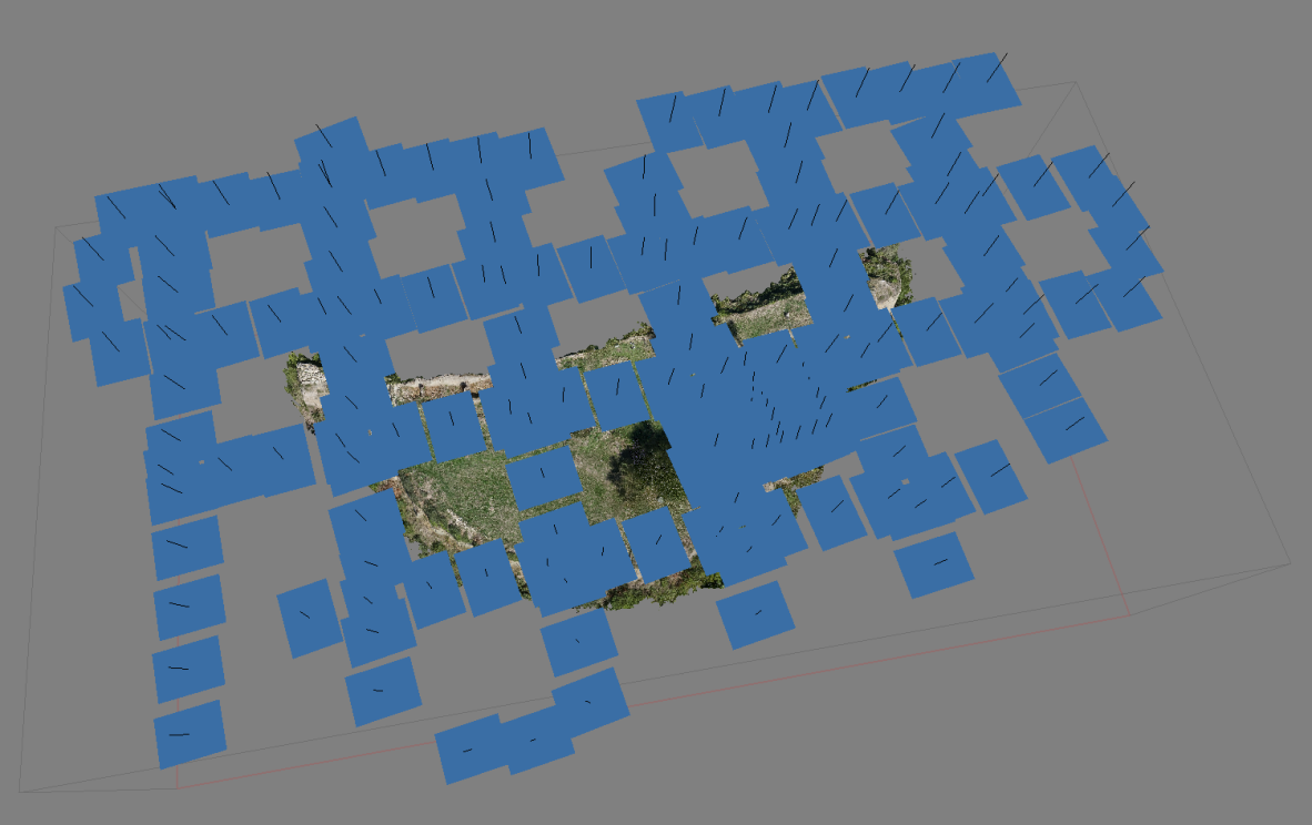 Positioning of the flight photo centers
At the church, 900 photographs were used, taken with both fixed-lens cameras and a drone. From the latter, top-down photos were taken to record the inaccessible upper sections, the roof, and perpendicular shots of the cliff face façade in order to reconstruct it in three dimensions.
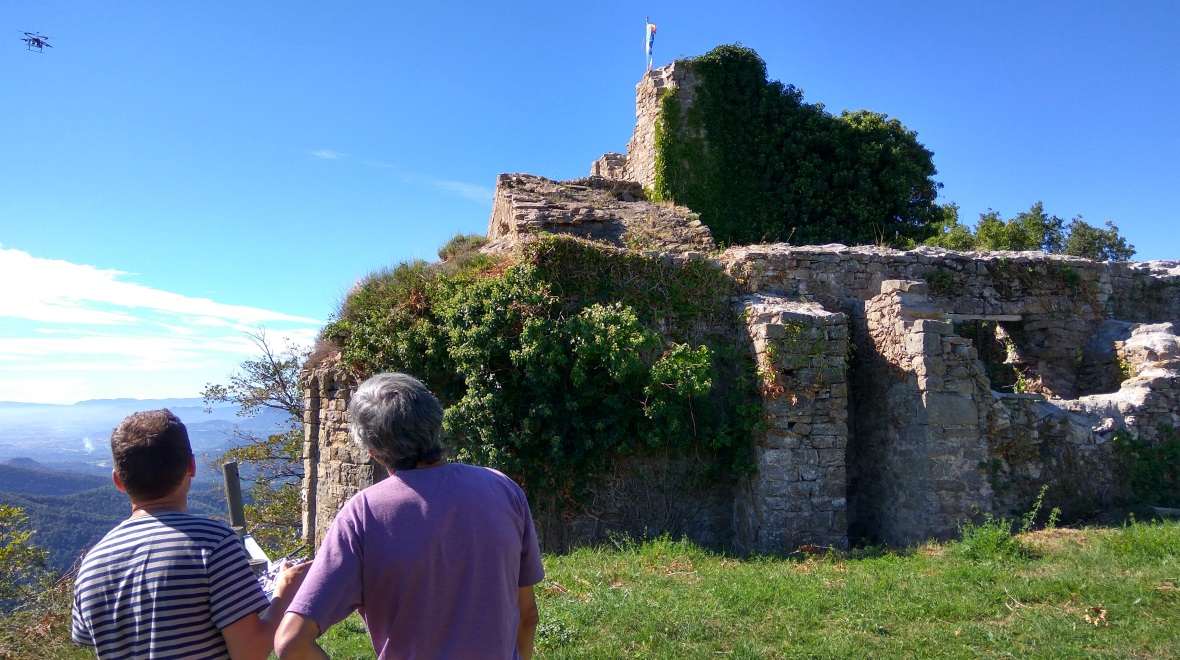 Acquiring photographs perpendicular to the cliff face
4th Phase. 3D model calculation and result retrieval.
Results
The work performed results in a three-dimensional model with photographic texture which, aside from its spectacularity, is a working base that allows us to obtain, from a virtual video tour to scaled orthophotos of the different elevations or plans, on which to draw with CAD with great precision. (for example, it is possible to draw stone by stone).
Likewise, complete sections of the model can be generated, providing precise details of wall widths or their inclinations.
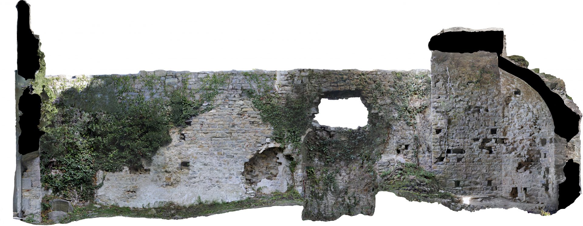 Longitudinal section of the Church of Santa Maria

View of the remains of Besora Castle
An orthophoto of the entire sector has also been obtained. It should be noted that by overlaying it onto the 3D model, measurements of the retaining walls in one of the excavated areas—which were exposed at the time of the flight—could be extracted, eliminating the need to send measurement equipment back out and collect the data while sitting comfortably in the office.
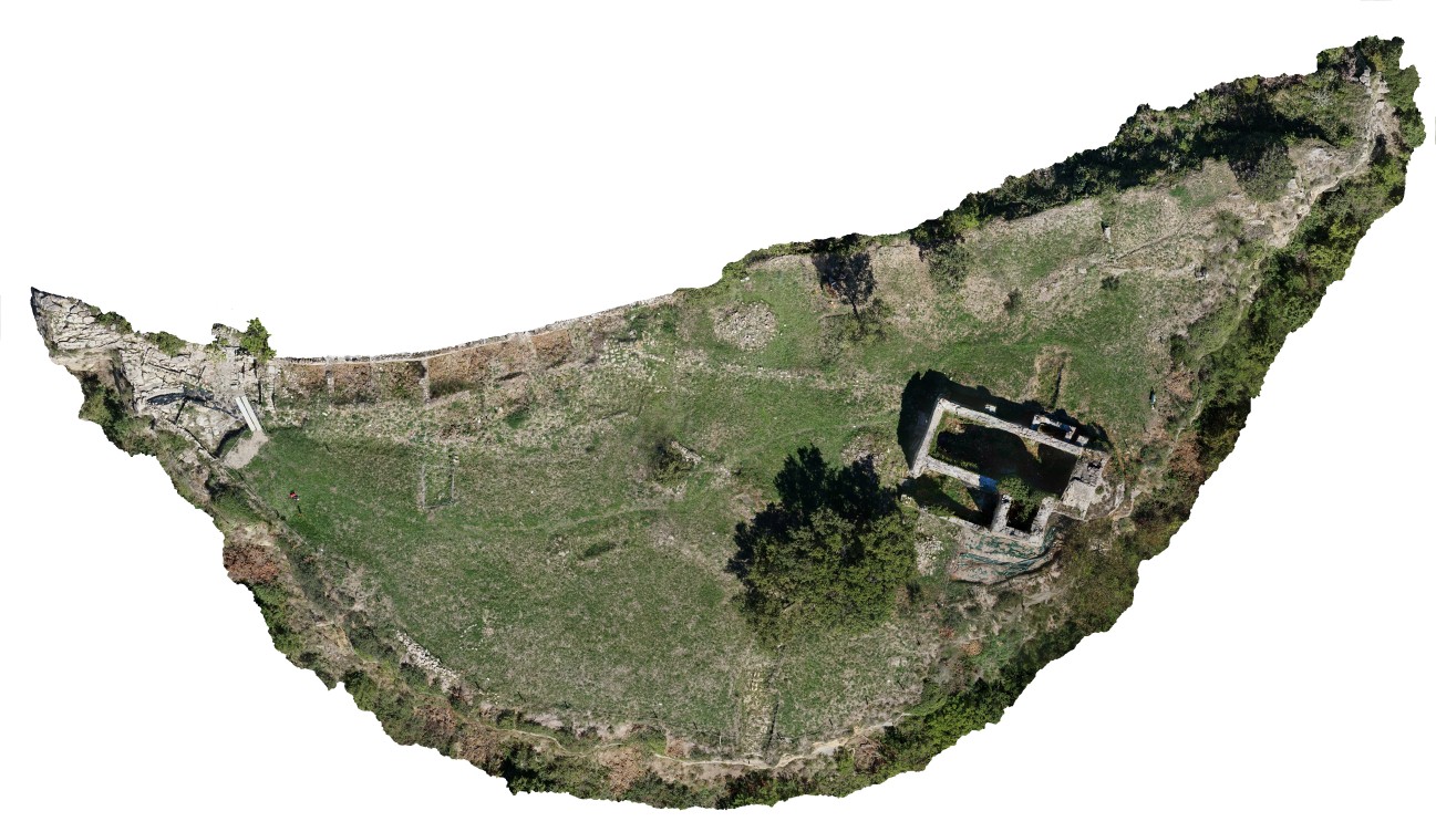 Orthophotography of the entire archaeological complex
The work carried out was part of the Bachelor's Degree Final Project in Geomatics and Surveying Engineering by Víctor Asensi Pous, an employee of Altiplà Surveying Services, and was carried out pro bono for the Friends of Bisaura Association, with the occasional collaboration of Xavier Roma.