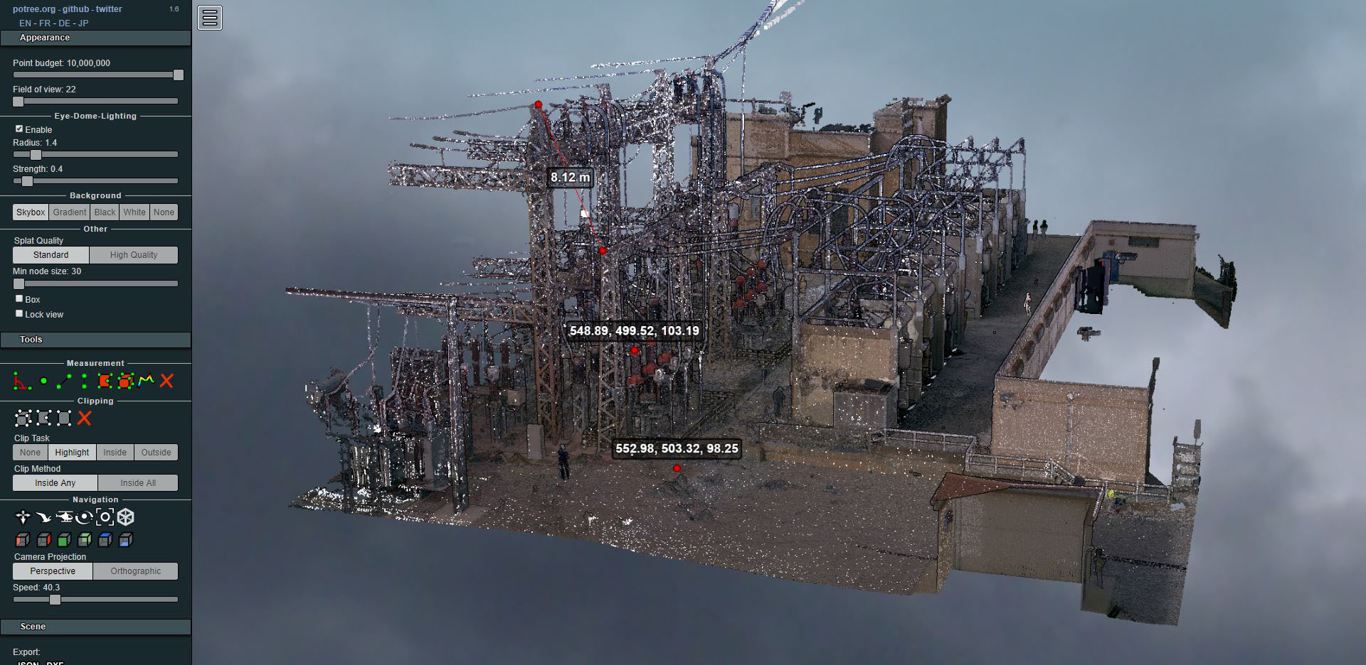
Laser scanning of an electrical substation
- Uncategorized


In recent months we have carried out the measurement of a 500 hectare farm in Canalda, in Alt Solsonès, at the foot of the Port del Comte mountain.
It is a basically forested estate, of great beauty, with some pasture land and many cliffs. The fauna stands out above all, home to wild boar, chamois, roe deer, vultures and various birds of prey, among others. The village of Canalda also stands out for its more than 1000 years of history.

Objective of the topographic work
The abandonment of rural and mountain areas for more than 50 years has in many cases led to ignorance of the boundaries (limits) by their owners or heirs.
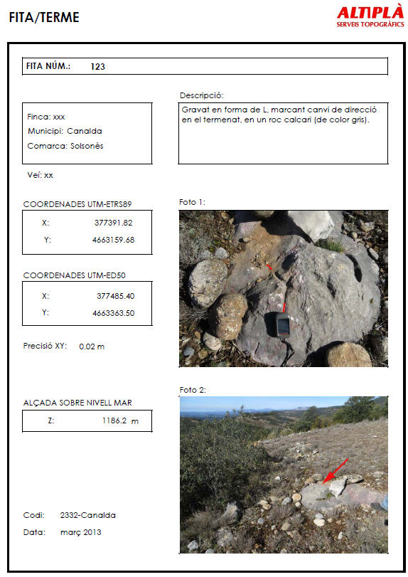
In this case, we consider that the most important part of this work is, with the help of the owner, to carry out a good cataloguing and georeferencing of all the terms (or landmarks). This will allow us to ensure the knowledge of the landmarks beyond their current owner or, if applicable, their restitution.
It is important to note that people who know these terms tend to be elderly and that with their disappearance this knowledge could be lost forever.
We must also take into account that having this work can allow us to resolve discrepancies with the cadastre or registry, in addition to obtaining the real surface area of the property.
Characteristics of topographic works
The working scale will be 1:2500 or 1:5000 and we will use the existing cartography (1:5000) and orthophotos at a scale of 1:2500 as a basis.
It is recommended to use the ETRS89 coordinate system, since we are basically carrying out archival work and that can be consulted many years from now.
Due to the extension of the work area, the use of GPS is essential. Due to the poor telephone signal, we will work with a base and RTK link. The accuracy of the points will therefore be centimetric or sub-metric for areas with a lot of vegetation density.
Types of terminates
We will encounter three types of terms or limits:
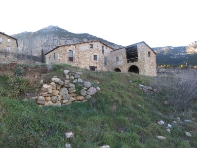
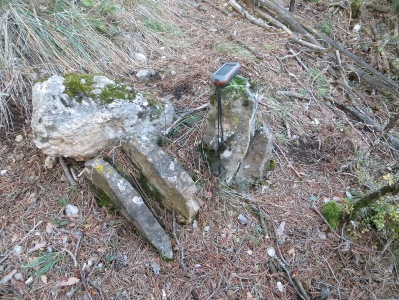
Documentation to include
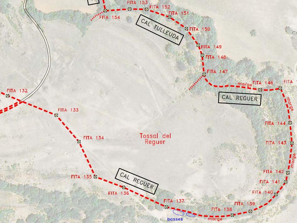
2. Plan with landmarks and boundaries, with description and neighborhood of each boundary and surface of the property.
Landmarks or cadastre
The easy one access to the Cadastre Electronic Office Currently, this has led many owners to ignore the landmarks that demarcated their property while giving total credibility to the cadastre, forgetting that its function is merely revenue collection. Nothing could be further from the truth.
In this case, the surveyor has had to dedicate part of his initial efforts to convincing the owner that what he really needs is to have his landmarks measured and thus obtain the real surface area of his property.
Termination
If we want to obtain an even more useful document, we will have to negotiate with the neighbors (in Spanish “deslindar”). The neighbors will show their agreement or not and, if necessary, they will sign the respective agreements. Through these agreements we will be able to make the cadastre correct its errors (it is a procedure called discrepancy correction).